And suddenly, here is spring again! It’s been a while since the last time I posted some landscapes here… But if you read my last post, you know the reason why it has taken me too long to publish again. Well, lets’s see if I can start posting again more frequently. I have soo many places and photos to show you!
Where was I. Last time I posted, back in October, I was showing you the first part of our little summer trip to the Engadin mountains in Canton Graubünden. We stayed there for a few days, exploring the stunning surroundings of this beautiful alpine valley at 2000m above the sea. Lakes, mountains, glaciers… it has everything!
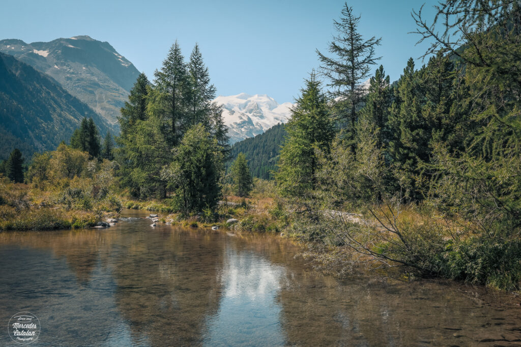
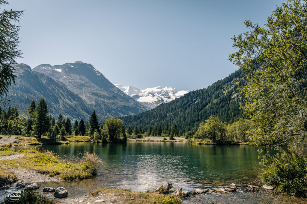
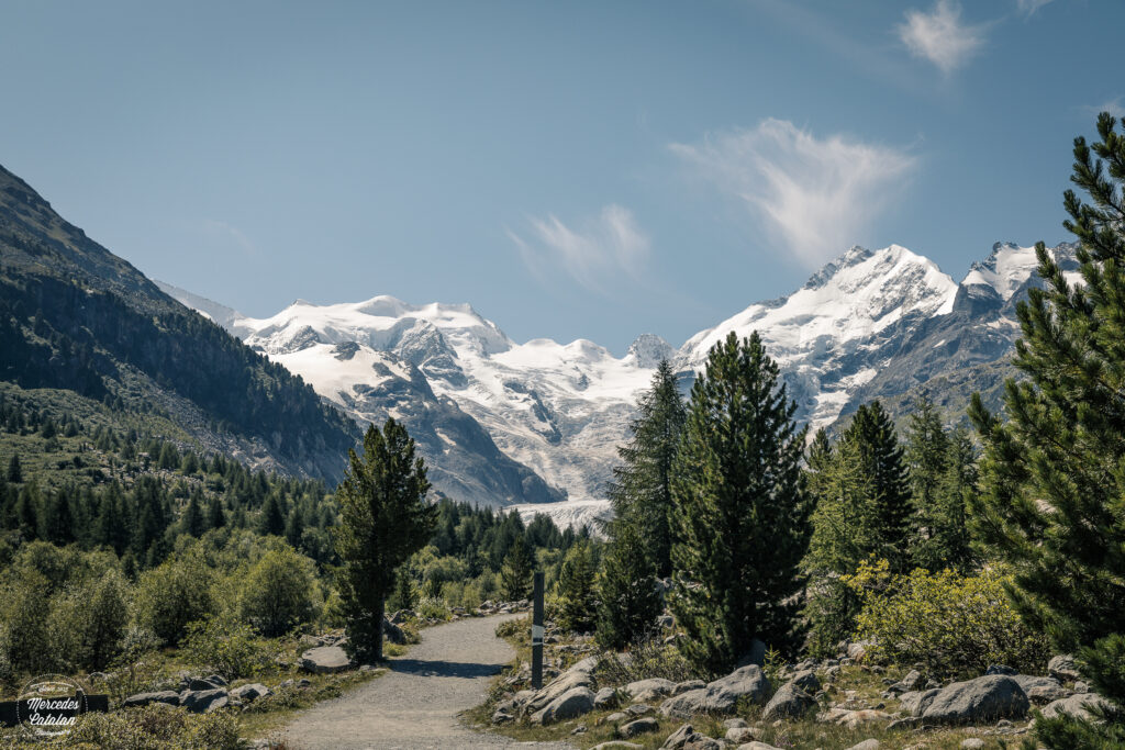
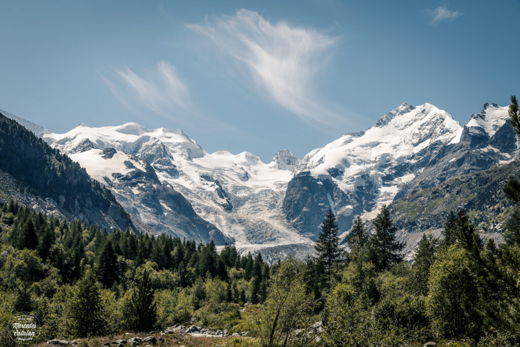
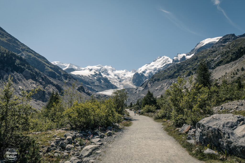
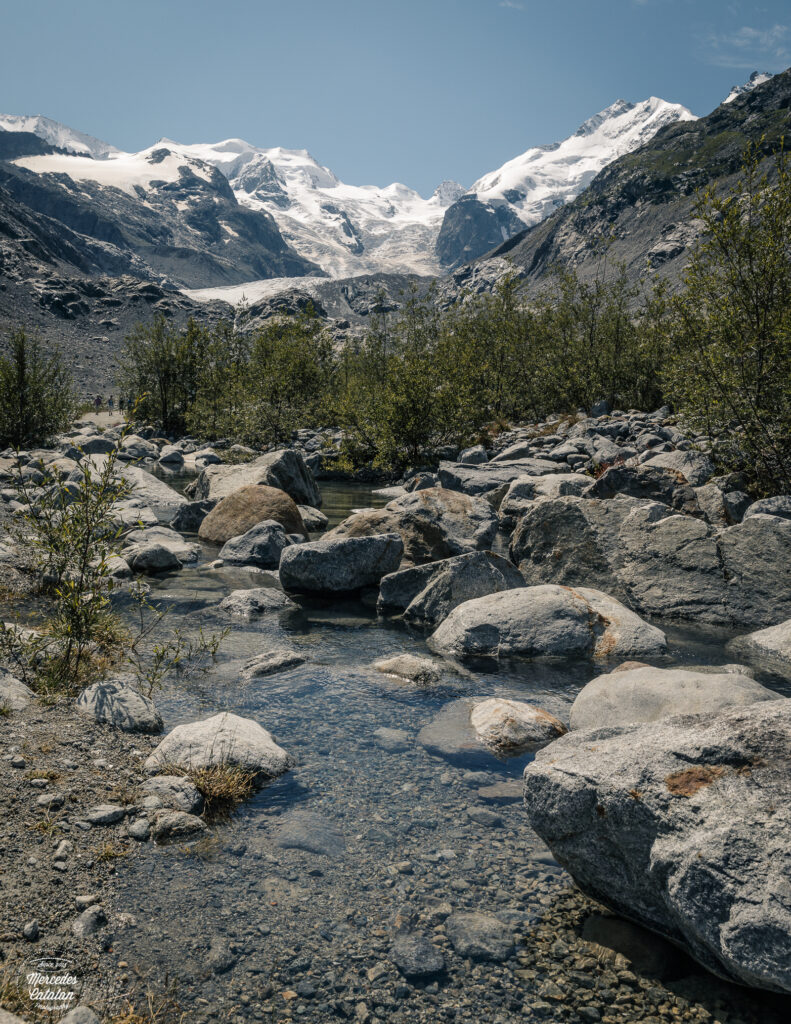
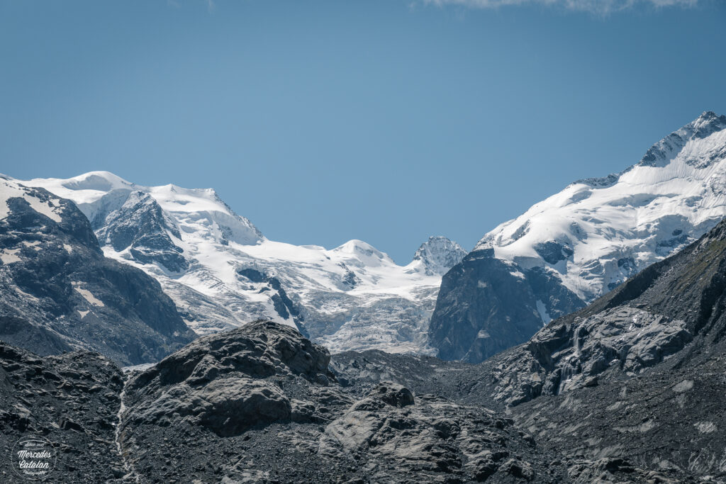
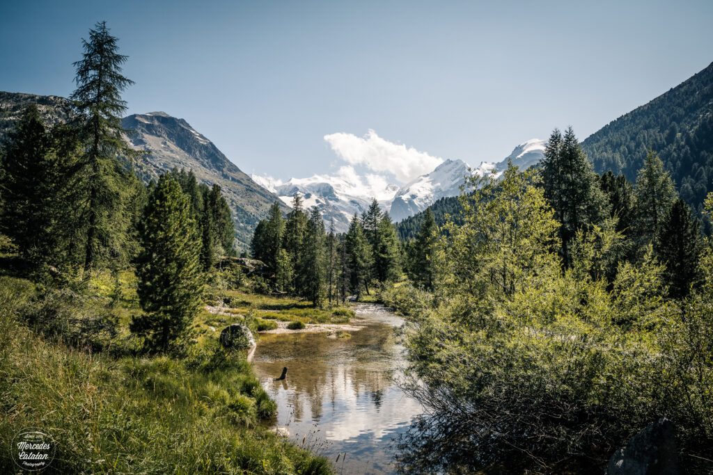
For our second day in Engadin we decided to do an easy “baby stroller friendly” hike (we did it with a stroller, but I would reconsider this description for this hike, hehehe). We went to see the Morteratsch glacier, the largest glacier in the Bernina mountain range. As you will see in the photos below, the views of this glacier and its surroundings are impressive. But so different to what I found in the Internet while I was planning this hike. The reason? The huge glacier has receded a lot during the last years…
In that sense, this is a very pedagogic hike. Since 1878, measurements of the glacier have been taken. As you approach the glacier, you can see the signs of how far the glacier reached on a certain year. At the beginning, you can see that the glacier wasn’t melting that fast. But as you get closer to the glacier, the gaps between signs get longer, showing how the melting accelerates. Between the beginning of the measurements and 1998, the glacier lost around 1.8km in length. From that point onwards, the melting speed increased, and the glacier has lost another kilometre just in the last 10 years. So comparing the photos I had seen to what I found in Morteratsch, they were very different pictures. In the photos, the trail reached the ice of the glacier, but as you can see below, the ice has receded so much that the end of the ice tongue is hardly visible from the path. Still, the view of the Bernina mountain range covered in eternal ice is stunning and well worth the hike!
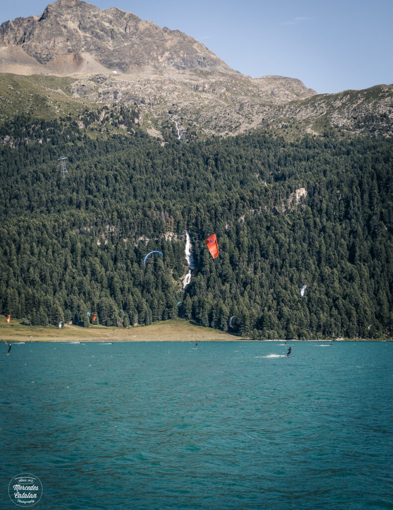
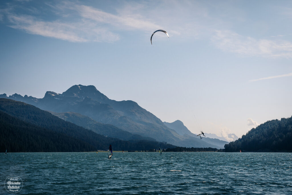
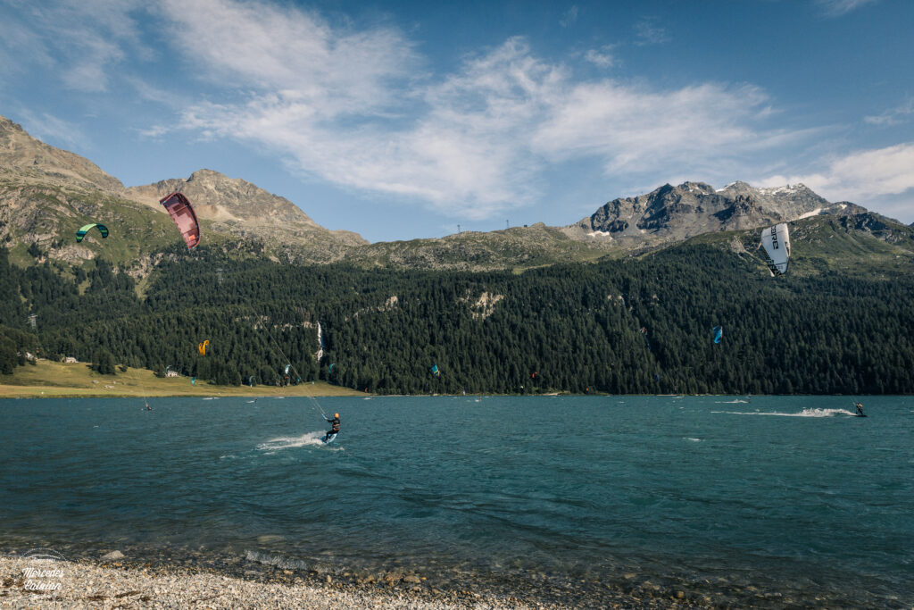
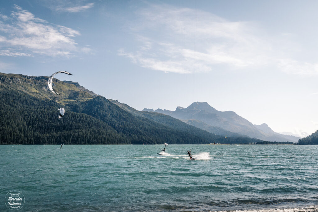
Later that day, we went to see something very unique. In the Engadin valley, the wind is quite strong. Perfect conditions to practice water sports. Yes, the Silvaplana lake is home to a very active wind and kite surf hotspot in the middle of the Alps. It is quite a postcard to watch the colorful kites from the kite surfers and the sails from the windsurfers with the Alps covered in green forests and waterfalls in the background.
Here are some photos I took during this second day in Engadin. I hope you like them!
Canon EOS 5D Mark IV 30mm f/11 1/200sec. ISO160
Canon EOS 5D Mark IV 28mm f/11 1/800sec. ISO100
Canon EOS 5D Mark IV 47mm f/11 !/640sec. ISO160
Canon EOS 5D Mark IV 57mm f/11 1/640sec. ISO160
Canon EOS 5D Mark IV 70mm f/4.5 1/2000sec. ISO160
Canon EOS 5D Mark IV 24mm f/11 1/640sec. ISO160
Canon EOS 5D Mark IV 28mm f/11 1/640sec. ISO160
Canon EOS 5D Mark IV 70mm f/7.1 1/2500sec. ISO160
Canon EOS 5D Mark IV 24mm f/11 1/500sec. ISO160
Canon EOS 5D Mark IV 63mm f/11 1/320sec. ISO250
Canon EOS 5D Mark IV 57mm f/11 1/2000sec. ISO250
Canon EOS 5D Mark IV 24mm f/11 1/2000sec. ISO250
Canon EOS 5D Mark IV 70mm f/11 1/2000sec. ISO250
Welcome back! Thanks for taking us along on your beautiful hike.
Thanks a mil, Anne! I hope I can do this often… at least more often than the last year, hehehe. I have so many photos to publish and so many places to take you! 🙂 And hiking season (and travel season!) will start soon for us! I’m so looking forward to this summer!
Immense natural beauty and picture perfect mountains the profile of some which I can just remember from my visits back in 2011 – It just occurred to me that the incredible beauty of this region might also coincide with avalanches in winter and perhaps earthquakes, as well?
Thanks a mil!! I love this area of Switzerland. The canton of Graubünden (or Grissons) can make you feel tiny and some areas feel very remote and isolated… not Engadin, of course! This part is very popular! But we still found some nice places not so crowded to hike!
Uummm, avalanches yes! I guess it’s the same in all the Alps. There are occasions were snow accumulates so much that there are red alerts for avalanches in almost every valley, hehehe. (there was a very interesting documentary on Netflix, “The Horn”, about the rescue helicopters in Zermatt. In one episode, they showed how they manage, or avoid, the avalanches, provoking them with explosives thrown from the helicopter before they occur naturally and provoque accidents!!!) Same happens with floods, there are quite a lot in the mountains in spring and summer with the storms, sometimes catching unaware hikers or mountaineers… 🙁 Fortunately, I haven’t heard anything about earthquakes in Switzerland!! 🙂
But here’s an interesting fact about earthquakes and the Alps… did you know that the famous Matterhorn was formed by the collision of the African and European tectonic plates millions of years ago? And actually, and here’s the funny fact, the Matterhorn is on the African plate, not the European!!
I knew about the colliding tectonic plates producing the Swiss Alps having studied geography in school. That is why I wondered about earthquakes in the region. They have earthquakes in the Himalayas so why not the Swiss Alps? But I didn’t know the Matterhorn was in the African plate.
Pingback:Summer in Engadin. Part IV – Mercedes Catalan
Goodness – it is hard to pick one photo here that stands out as they are all outstanding. The views from Pia Corvatsch is truly spectacular!
Hope the heat diminishes soon!